
Dearthwood Maps: UK Maps API & Geocoding Platform from £4.99/month
Maps That Work. Without the Per-Request Tax.
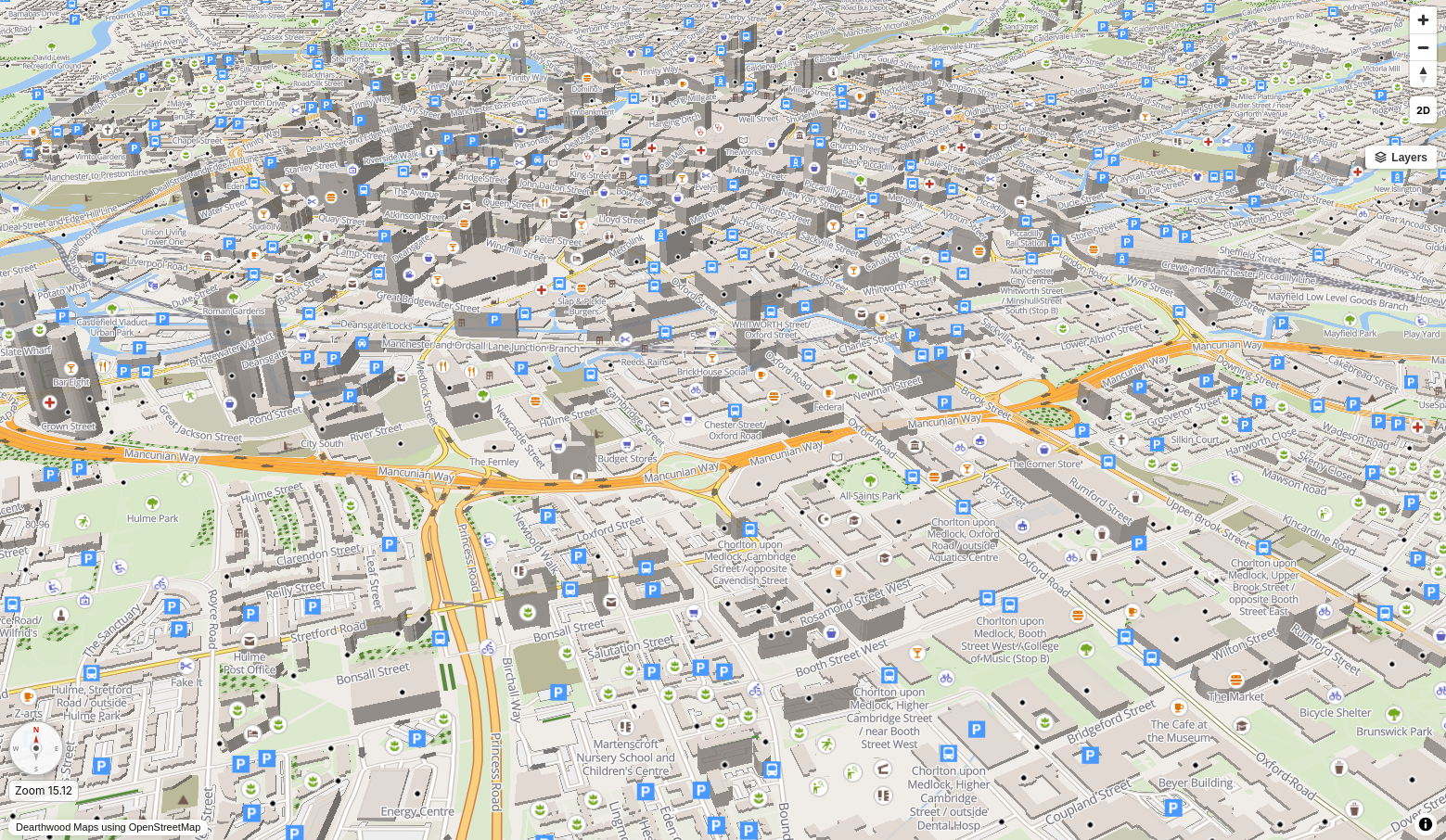
A complete UK maps API built exclusively for Great Britain, Ireland, the Isle of Man, Jersey, and Guernsey. The Google Maps alternative built for UK developers: geocoding API, routing API, isochrone API, and navigation on a flat monthly subscription, not a per-request bill that scales against you. UK-only coverage means every endpoint is optimised for the roads, postcodes, and place names your application actually uses.
- 🇬🇧 GB, Ireland, IOM & Channel Islands
- 🔒 Zero Tracking
- 🗺 OpenStreetMap
- 🔑 API Key Auth
Flat monthly pricing. No per-request tax.
Stop Paying Per-Request for Maps
Pay-per-request map billing starts cheap, scales fast, and the invoice at the end of the month is never what you expected. Dearthwood Maps is a flat rate maps API: one flat monthly subscription, predictable cost, no per-call billing, no surprise invoices. The only flat rate maps API built exclusively for UK coverage. A genuine Google Maps alternative for UK developers who are tired of paying by the request.
| Feature | Dearthwood Maps | Big Tech Maps APIs |
|---|---|---|
| Pricing model | ✓ Flat monthly subscription | Pay-per-request (from $2–$10 per 1,000 calls) |
| Geocoding (address → lat/lng) | ✓ Included in monthly plan | $5 per 1,000 requests |
| Directions / routing | ✓ Included in monthly plan | $10 per 1,000 requests |
| Travel time zones (isochrones) | ✓ Included | ✗ Not available in Maps API |
| Distance matrix | ✓ Included | $10 per 1,000 elements |
| Nearby amenity search | ✓ Included | $32 per 1,000 requests (Places API) |
| Vector map tiles | ✓ Included, no per-load fee | $7 per 1,000 map loads |
| Your data stays yours | ✓ UK-hosted, zero telemetry | ✗ Big Tech provider processes all your request data |
| URL compatibility | ✓ Drop-in compatible with the standard mapping URL structure used by the big providers. | — |
| Surprise bills | ✓ Never. Flat subscription, nothing more. | ✗ Yes, if you exceed free tier |
Built for Real Applications
A full-stack UK maps API using OpenStreetMap data. Geocoding API, routing API, isochrone API, distance matrix, postcode boundary API and more — features the big mapping providers simply do not offer.
-
Forward & Reverse Geocoding API
UK geocoding API: address to coordinates, coordinates to address. Full UK postcode support. Works with street addresses, landmarks, and partial postcodes. No separate billing per lookup.
-
Routing API: Turn-by-Turn Directions
Drive, walk, or cycle. Full maneuver instructions with distance and duration per step. Multi-waypoint routes. Response matches the standard Directions API format exactly.
-
Isochrone API: Travel Time Zones
Show the reachable area within 15, 30, 45, or 60 minutes from any point, for driving, walking, or cycling. GeoJSON output, render directly on your map. Used for catchment area analysis, site selection, delivery zone planning, and service coverage mapping. This isochrone API is included in the UK platform as standard. Not available in standard mapping APIs.
-
Distance Matrix
Travel time and distance from multiple origins to multiple destinations simultaneously. Perfect for "which of our sites is closest?" queries. Up to 5×5 pairs per request.
-
Nearby Amenity Search
Find the nearest hospital, pharmacy, GP, supermarket, pub, school, parking, and 13 more categories, within any radius from any point.
-
Vector Tiles
Vector map tiles for Great Britain, Ireland, the Isle of Man, Jersey, and Guernsey. Render and style them however you like. No per-map-load fees, ever.
-
Elevation Profile
Elevation data returned along every route. Visualise rise and fall for cycling and walking applications. Total ascent, descent, max and min elevation included.
-
Place Text Search
Free-text search for places, businesses, and points of interest across Great Britain, Ireland, the Isle of Man, Jersey, and Guernsey. No Places API billing, ever.
-
API Key Authentication
Per-site API keys with usage logging. See which key is making which requests. Rate limiting included. Revoke individual keys without affecting others.
-
Point Elevation Queries
Query elevation in metres at any coordinate or along a polyline via a dedicated endpoint matching the standard Elevation API structure. Also visualised as an interactive profile chart in the map component.
-
Drop-In Navigation Widget
A single-file PHP widget you embed via iframe. Five modes in one file: full turn-by-turn navigation, live customer tracking, fleet dispatch overview, coverage radius, and a server-side travel-time API. No npm, no SDK, no framework. Paste the iframe, point it at your API key, done.
-
Maps API WordPress Plugin
A Gutenberg block for any WordPress site. The only maps API WordPress plugin built specifically for UK coverage. Set a postcode and miles, get a polished radius coverage map on your page. Your API key is stored server-side in WordPress options, never exposed to visitors. This maps API WordPress plugin ships free with any paid plan.
Drop-In Map Component Included
Every plan includes a production-ready, self-contained HTML map page. Drop it on any website. Point it at your subscription credentials. Done.
-
Live GPS Navigation
Full turn-by-turn navigation mode. Map follows and rotates with your heading. 45° tilt perspective view while driving.
-
Voice Guidance
British English voice instructions via the Web Speech API. Reads each maneuver as you approach it. Mute toggle. Zero dependencies.
-
Off-Route Detection
Silently reroutes if you stray more than 50m from the planned route. Announces "Recalculating" and redraws instantly.
-
Speed Display
Live speed readout in km/h from the GPS signal. Amber warning if you exceed a configurable threshold per travel mode.
-
Draw Radius
Draw precise radius circles in miles, km, or metres from any searched location. Shows enclosed area in km². Stack multiple rings.
-
Measure Distance
Click multiple points on the map to measure total distance. Running total in km, miles, and metres. No API call needed.
-
Drop & Export Pins
Drop named pins anywhere on the map. Export the complete set as a CSV with label, latitude, longitude, and notes.
-
Heatmap Layer
Paste in a list of coordinates, hit Draw. Instant density heatmap rendered on the map. Useful for visualising client or delivery locations.
-
Share Route Link
Generate a shareable URL that reloads any route with origin, destination, and travel mode. No database required.
-
Export Map as PNG
One-click export of the current map view as a timestamped PNG. Captures everything visible including routes, pins, and zones.
-
Right-Click Location Info
Right-click anywhere on the map for the address, exact coordinates, and an Open Location Code (Plus Code), computed offline, no extra API call.
-
Find Nearest
One-tap search for the nearest hospital, pharmacy, GP, dentist, nursing home, supermarket, fuel station, and more, plotted directly on the map.
-
Offline Map Caching
A Service Worker caches map tiles as you browse and navigate. Routes load from cache when connectivity drops, so no missing tiles mid-journey. Essential for field work and navigation in areas with poor signal.
-
UK Postcode Boundary API
Look up any UK postcode or outcode and draw its precise boundary polygon on the map. Area and centroid displayed. Clear with one click. The postcode boundary API is included as standard: perfect for catchment area analysis and site selection. No other UK maps API includes a postcode boundary API at this level.
-
Cycling Layer
Toggle a dedicated cycling overlay showing cycleways, and colour-coded national, regional, and local cycle routes. Styled separately from the base road network and works across all map themes.
Two Ways to Integrate. Pick Yours.
Every paid plan includes both. Use the WordPress plugin if you run a service-based business website. Use the PHP widget if you're a developer building something custom. Or both.
-
Dearthwood Maps for WordPress
A proper Gutenberg block, installable like any other WordPress plugin. Built for service businesses: plumbers, electricians, cleaners, mobile mechanics, removals, tradespeople. Anyone who needs to show visitors exactly which area they cover.
Search "Dearthwood Radius Map" in the block editor. Drop it on any page. Set the postcode, the radius in miles, the map dimensions and zoom, and optionally a label with your business name. Saves like any other block.
Security built in: Your API key lives in the WordPress options table on your server. Every map request is nonce-gated and proxied through admin-ajax.php, so the key never appears in HTML or JavaScript sent to your visitors' browsers.
-
Single-File Navigation Platform
A self-contained PHP file that gives you a complete navigation product in five modes. Drop it on any PHP 8.1+ server alongside the MapLibre JS files and serve it over HTTPS. That's the whole install.
- Nav mode: full turn-by-turn with voice, 3D buildings, speed cameras, lane guidance
- Follow mode: customers watch their driver live, per-order isolated
- Overview mode: dispatcher view, all drivers on one map
- Radius mode: postcode coverage circles for landing pages
- Travel time API: server-side JSON or plain text, perfect for cron jobs and SMS
Production-ready: HMAC-signed sliding sessions, per-key rate limiting, path allowlist.
🚚 Built for Real Businesses
Delivery drivers see turn-by-turn directions. Customers see their order moving in real time. Dispatchers see the whole fleet. Service businesses show their coverage area on a clean radius map. One subscription, one access key, every use case covered. No per-driver fees, no per-map-load charges, no monthly active user counts.
🔒 UK GDPR Compliant. Your Users' Location Data Stays Private.
When a user searches an address or requests directions through a Big Tech mapping service, that provider knows. They log it, profile it, and sell against it. Dearthwood Maps is built on UK infrastructure with full UK data sovereignty: no request data leaves the UK, no tracking, no profiling, no third-party analytics. For developers building applications that handle UK user location data, that is not a nice-to-have. Under UK GDPR it is a material consideration. UK-only infrastructure means your data never leaves the UK. Your users' movements are nobody's business but yours, and even you only see what you choose to log.
Simple, Honest Pricing
One flat monthly fee. No per-request billing. No surprise invoices. Cancel any time. A flat rate maps API with access issued within 24 hours of payment.
-
Tier 1HobbyistPersonal projects, prototyping, learning. Get started without the faff.£4.99per month
- 1 API key
- 1,000 requests / hour, per key
- Geocoding & reverse geocoding
- Routing API: drive, walk, cycle
- Nearby search
- Vector tiles
- Isochrone API included
- Ready-made map component
- No distance matrix
- No elevation data
-
Tier 2DeveloperProduction sites, client work, small SaaS applications.£19.99per month
- 3 API keys
- 5,000 requests / hour, per key
- All geocoding endpoints
- Routing API: all modes
- Nearby amenity search
- Distance matrix (5×5)
- Travel time isochrones
- Elevation profile data
- Ready-made map component
- Email support
-
Tier 3Small BusinessBusy sites and growing apps that need more headroom per location.£59.99per month
- 10 API keys
- 25,000 requests / hour, per key
- All endpoints, all modes
- Distance matrix
- Travel time isochrones
- Elevation data
- Full vector tile access
- Priority email support
- Usage dashboard (coming soon)
- SLA: 99.5% uptime commitment
-
Tier 4Small/Medium EnterpriseHigh-traffic platforms and agencies managing multiple clients.Price on
Application- 25 API keys
- 100,000 requests / hour, per key
- All endpoints, all modes
- Distance matrix
- Travel time isochrones
- Elevation data
- Full vector tile access
- Priority email support
- Usage dashboard (coming soon)
- SLA: 99.9% uptime commitment
-
Tier 5EnterpriseUnlimited scale, custom SLA, dedicated account management.Price on
Application- Unlimited API keys
- Unlimited requests, no rate cap
- Dedicated infrastructure
- On-premise deployment option
- Custom SLA negotiated
- Dedicated account contact
- Custom data imports
- Priority feature requests
- Phone & email support
- NDA & data processing agreements
Typically 70–85% cheaper than usage-based mapping costs
💡 Got a Feature Request?
We build what our users actually need. If there's a mapping feature your application requires that isn't listed here, get in touch. Paying subscribers get their requests prioritised.
Ready to Ditch the Per-Request Tax?
Get in touch to get your UK maps API access set up. We'll have you making live routing and geocoding calls within 24 hours.
No contracts. Cancel any time. 24-hour setup. UK-hosted.